

What these ruins are
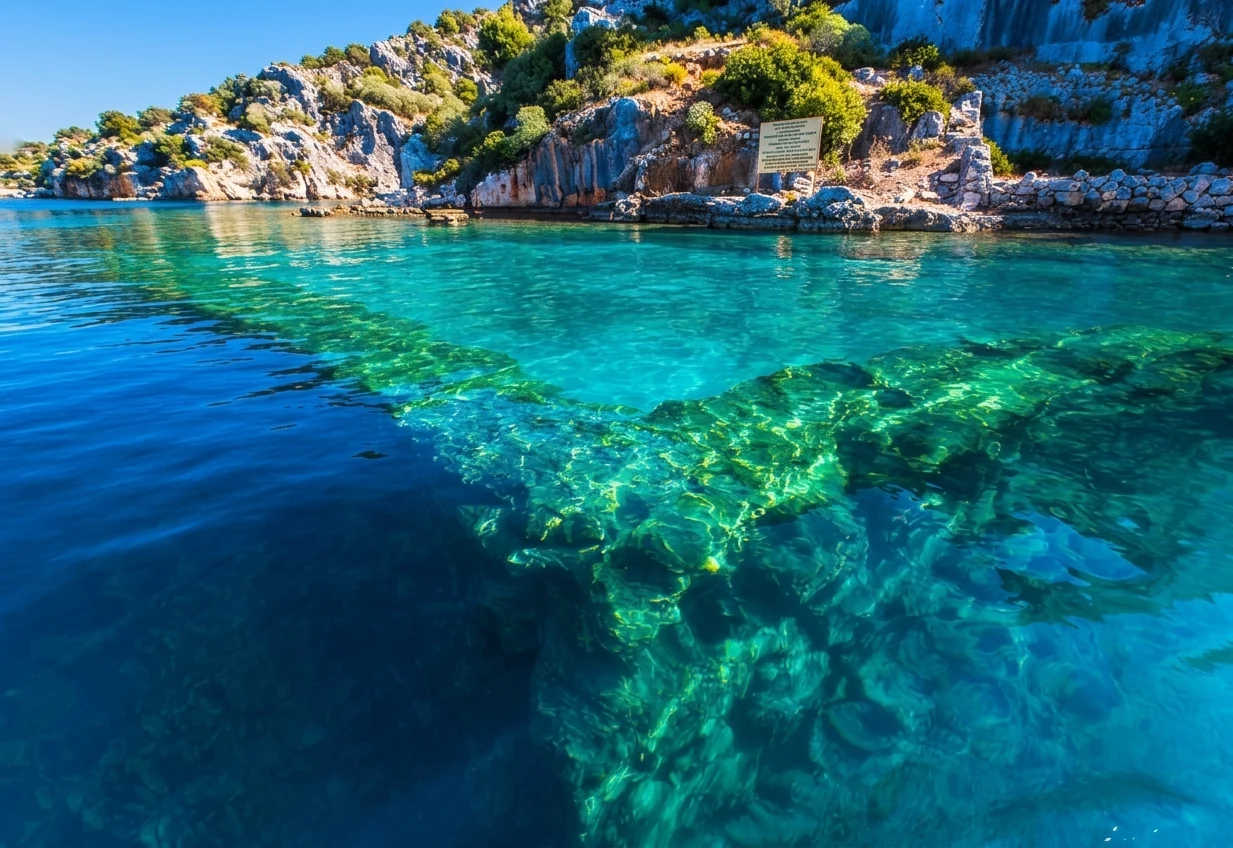
The remains of a settlement survive on the north shore of the island: stone stairways, house walls and quays. The Antalya culture directorate says they partly sank in antiquity because of earthquakes. Some buildings stand on the shore, others go down to a depth of 4–5 metres.
Buildings at the water's edge
Stone walls at the edge of the water. From a boat you can clearly see where the buildings go under the surface.

There are several sunken settlements like this around Kekova island. Nearby, Lycian sarcophagi, breakwaters and building foundations are visible in the water, so the whole coast from Üçağız to Kaleköy looks like one large archaeological landscape.

Under the water
The outlines of stone buildings show through clear water: this is how the ruins look from a boat in calm weather.
How best to see the ruins
The ruins are clearest in calm weather, when the water is clear and the surface has no ripples. If the sea is rough, the outlines underwater almost disappear; then it is worth moving the trip if you can.
Boats go slowly along the shore so you can look at the steps and foundations. It is better to sit on the island side; ask the crew which side of the boat will face the ruins.
A kayak lets you get closer to the shore and more quietly, but the organiser sets the route and the permitted stops. Do not expect to swim or dive right by the ruins; the crew announces the rules on the spot.

The protected area and UNESCO
The island and the surrounding coves lie within the Kaş–Kekova Specially Protected Area of about 260 km². Besides Kekova island, the area includes several small islands.
Since 2000 Kekova has been on UNESCO's tentative World Heritage list. This means it is recognised as a candidate, but no final decision has been taken.
How to join a trip
You can hardly reach these shores by land, so everyone comes by boat. Trips leave from Üçağız, Kaş and Çayağzı near Demre; Üçağız is closest to the island.
The sunken city is usually combined in one trip with Kaleköy and Simena castle. If the climb to the castle matters to you, check whether the programme includes a landing at Kaleköy and how long you get ashore.